What do volcanolgists do on vacation?

As I sit in a lab in Australia waiting for my samples to make it through quarantine, maybe it’s a good time to continue my hopeless attempts to catch up on my horribly neglected blog. So, this time…CHILE!

Part of academia is going to conferences to share your research with other scientists in your field. As volcanologists, we are pretty good at making sure those conferences also often happen to be in places with awesome volcanoes. That way we can learn about local interesting geology in addition to presenting our work. I was lucky enough to attend the Cities on Volcanoes 9 conference in Puerto Varas, Chile, last November. It’s a conference all about volcanoes and the people who live near them (hence the name), hazard mitigation, communication, and more.

I was able to head to Chile a week before the conference to have a bit of a travel vacation with my workmate Mary Anne. What did I do on this vacation? Well…there’s a lot of nice scenery in Chile, and much of it includes tall pointy mountains that hot rocks come out of…and I may have spent most of my time looking at that.

But first, Santiago!

On our way to the Región de los Lagos, the part of the country where the conference was, we had a one day stop in Chile’s capital, Santiago. Enough time to take a look around, check out some nice parks and markets, and have some great food.


Onwards to volcanoes: Hornopirén

The next day Mary Anne and I flew down to Puerto Montt, the city at the northernmost end of Patagonia, and rented a car so we could drive to some of the more out-of-the-way areas to the south. We were taking the Carretera Austral, the road that goes from the end of the Pan-American Highway as far south in Chile as you can go. It’s very much still a work in progress. Much of it is unpaved, and there are several ferry crossings where the road comes to an end.

Our first stop was in Hornopirén, a small town near a national park and a few volcanoes. We did our first ferry crossing and found our way to a nice cabaña with fireplace–lucky since it spent the next day raining so hard we could barely do anything!

We were supposed to head on fairly quickly to our next location, but a ferry scheduling issue meant we had to stay an extra day. The silver lining was that it meant we had time to do the things we were rained out of the first day. We had a great hike to Lago Cabrera, the site of Chile’s biggest volcanic death toll. In the 1950s there was a rockfall from Yate volcano that fell into the lake, which caused a tidal wave destroying a settlement on the other side, killing 26 people.

Onward to…more volcanoes?: Parque Pumalín

Once we finally sorted our ferry, we headed off further south. First a 3 hour trip, a short driving break, and then another short ferry ride to get to Parque Pumalín, a privately maintained conservation area with beautiful views and–you guessed it–a few more volcanoes!

The park is home to Chaitén volcano, which had a violent and destructive 2008 eruption, severely affecting the nearby town of the same name. As we drove through the park to the town where we were staying it was easy to see the effects of that eruption.

Our host gave us some recommendations for hikes the next day. Of course we were going to climb a volcano (duh…) but we had more time than that. We used to visit some waterfalls and more alerce trees. Our first hike was the Cascadas Escondidas trail, or the “hidden waterfalls”.

But of course the start of the show was Chaitén volcano. We took a few hour hike up to the top in the afternoon and got great views of the still smoking dome.

Back to work!: return to Puerto Varas

Our pre-conference week was coming to an end, so we hopped on a 9-hour ferry back up to where we started. I got to work on my Spanish quite a bit more by watching some extremely family-inappropriate pirated movies that were being shown and had a chance to get a different view of some of the places we’ve been.

Upon getting back, we had one more day with the car, so we took a trip to the the Saltos de Petrohué, a series of rapids and waterfalls near still more volcanoes!

Another thing that was fun about the trip to this point was the language. While I studied Spanish all through high school and have practiced it beyond that, I’ve never had the chance to use it in a practical setting before. In the places we went, most people spoke no English, so I had to stretch my Spanish knowledge to its limit, and it was super fun. I felt like I was improving as the trip progressed, and really happy with how well I did.

Halfway point in the trip is a good point for a break! I promise I will finish the second half soon! You believe me, don’t you?

Two Day Trips and a Hard Drive Crash

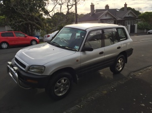
What better way to take advantage of your fancy new set of wheels than to explore the bounty of Auckland region’s awesome stuff?

IMG_2163

So fancy! But he/she/it still needs a proper name!

Auckland has quite a few nice regional parks with lots of neat hiking tracks and awesome views. Most of them are pretty easy to get to within an hour or so drive, making them great for day trips.

This post turned out mostly pictures and not too much history or description because, honestly, these are just pretty places that I don’t know all that much about. Hope you enjoy them.

Tawharanui

The first of the three parks I’ve visited recently was probably my favorite. Tawharanui is a little peninsula on NZ’s east coast north of Auckland, almost all the way up to Northland (the region that goes all the way to the northern tip of the country). It has a refuge for birds, cool beaches, big rocks to climb on, and pretty shells to find.

After a hour’s drive north on Route 1 (and a detour along a more scenic coastal road), you drive out onto the peninsula and lose elevation until you get to the park entrance.

Once you get into the park, you immediately get to see the awesome beaches and nice views of the Hauraki Gulf to the south.

We just looked around Tawharanui beach for a short while before heading farther into the park. The weather was a bit all over the place, so it was overcast and a bit misty at many points during the day.

The road through the park passes through a bird sanctuary with some cool blue and black long-necked birds, finally ending closer to the north side of the peninsula. While the beach on the south side was a bit rockier, the north side was a more traditional long strip of light colored sand.

Not sure if it has a name, but there was a large rock that we climbed up on towards the western end of the beach that gave pretty good views of the rest of the area.

After fully exploring the western end of the beach, we found a trail leading east along the beach towards the end of the peninsula. Along the way were some cool sea caves and ridges to climb.

We continued over the ridge to the second part of the beach, where we spent quite a while looking for awesome shells, and we found plenty! As you can see, by this point the weather had gotten quite nice (for the moment), great for sitting around and enjoying the scenery.

We actually spent so long hanging around this part of the beach that the tide started to go out! Things looked quite a bit different during our walk back to the car.

Since we didn’t have time to hike all the way out to the end of the track, I definitely need to come back here again to see the rest of the park!

Mahurangi

The second park I visited was in Mahurangi West, in the same direction as Tawharanui, just not quite as far north. This was a little less impressive, more of a nice place to have a picnic (as some people were) than a place to go hiking. There were just a couple short walks that we took to explore.

We did the two main hikes in the park which both led to views overlooking the water and took a little walk along the beach.


Disaster Strikes!

I said 3 regional parks, didn’t I, so where are the pictures from the last trip to Karekare/Mercer Bay? Gone into the aether, unfortunately…

My hard drive died last week, and though I was able to replace it successfully and restore my most recent backup, I hadn’t yet backed up my most recent photos, which sadly means they’re all gone.

More sadly is that I was next going to do another sciency post on my latest round of fieldwork in Taranaki and my first round of labwork in Wellington. Sadly, those are long gone as well, so it’ll have to wait for the next time. Luckily, that shouldn’t be too long, as I’m going to Wellington next week for labwork and a conference and back to Taranaki for some fieldwork just a couple weeks later.

The Pinnacle of Kiwi Adventuring

There’s so much to explore on the North Island alone, let alone all of New Zealand, and I’ve only scratched the surface, but I’m doing my best dammit! Since I haven’t yet reached the workload I had during a lot of my master’s (mostly since I have no data to analyze or samples to run yet), I can still get away fairly often to see new things.

A few weekends ago I went with a group of friends to do a tramping trip on the Coromandel Peninsula, a pointy bit of land on the other side of the Hauraki Gulf from Auckland (in theory you can see one from the other in good weather). There’s lots of spiky-pointy-mountainy bits there and some good trails for hiking.

We got a bit of a late start, but it was okay because our goal was just to hike in to the Pinnacles Hut for the night and then to actually see stuff the next day. It meant a bit of hiking in the dark, but the trail is pretty well maintained and we had head torches, so it wasn’t too bad, more long than difficult–took us around four hours to get to the palace of a hut–bunks for up to 80 people, gas stoves, and more! Did I mention the hut system in NZ is awesome?

When we got to the hut, we already had some lovely nachos for dinner waiting for us, courtesy of chefs Tim and Manu who ran ahead to start cooking since the rest of us were making slow time. Talk about tramping in luxury! We passed around some chocolate (an absolute necessity for tramping) and tea (and other stuff…) and had deep discussions about geology.

The next morning, we got up nice and early to see the sunrise from the top of the Pinnacles. It’s only about a 45 minute trek from the hut to the top, but it’s a lot more difficult than the previous night’s hike–lots of ladders and tight spots and big rocks to climb over. A combination of head torches and the slowly brightening sky made it a bit easier.

At the top, the view was pretty nice. There were a few different spots to look from, perched up on a rock, out on a ledge, out on another ledge. We got to see the valleys and peaks light up as the sun rose over the Pacific Ocean.

I did a bit of climbing around myself to get all the different views. The pinnacles themselves are somewhat eroded volcanic plugs, so there’s a mix of volcanic stuff left over, ignimbrites, etc. If you want to know more you’d have to ask a specialist.

It seemed like pretty much everyone in the hut got up for the sunrise. Good on ya, peoples!

It was fun to look around an imagine Led Zeppelin playing one of their Lord of the Rings-y songs.

IMG_1670

Tadaa!

After that, there wasn’t that much else to do, just head back down to the hut and collect our things.

After that, we headed back out, over bridges, down rocky staircases, over streams, and back home.

Actually, it was kind of nice to get back from a trip in the afternoon for once instead of late after midnight like usual.

Ain’t No Mountain High Enough (Okay, There Are Some Mountains High Enough)

The weather in winter may not be good for fieldwork on Mt. Taranaki, but it’s definitely good for wintery things in those select regions of the North Island that actually get snow. A weekend ago I went on a trip back down to Tongariro National Park with my friends Tim and Annika (and a couple of their tramping friends from Wellington) to do some mountaineering. Mountaineering is a really broad term that basically means what it sounds like–climbing mountains. It can involve a whole range of tools and difficulty levels, can be done on foot, on skis, with full climbing gear, etc. Since I and some of the others on the trip weren’t too experienced with this kind of thing, the trip we did was fairly low difficulty and was a good chance for us to learn to use some of the gear. Doing these trips requires some measure of flexibility–you have to be willing to change your plans based on the conditions in order to be safe. The couple members of our group who were more experienced were good at analyzing the avalanche warnings and looking at snow cover and deciding what the best climbs to do on each day were. Based on this, we decided to climb Mt. Tongariro on the first day, coming in from the western side. After starting off on the track, we pretty quickly veered off to take a more direct route straight up the mountain.

At first, we climbed a slightly steep slope to get up on a ridge where we could just walk up a gentle incline for a while, but after a certain point things got a bit steeper and gradually snowier. Still, for a while it was just climbing through snow, making sure to keep good footing.

At some point, it became too steep and slippery to make very much progress, so we turned around and went home.

Just kidding! That’s the point at which we strapped crampons to our boots and took out our ice axes. I’d used crampons before, but not like this–it was amazing how suddenly you could just walk straight up steep icy slopes without worrying about your footing. It feels kind of like being Spiderman! Meanwhile, you use the ice axe to keep your balance so you can lean uphill without falling over. You can also use it to stop yourself if you slide.

And just like that, we were at the top with a great view of all sorts of geologic goodness. Of course we could see Mt. Ngauruhoe in the distance as usual, but below us was Red Crater, part of the Mt. Tongariro volcanic system, which erupted in the early 20th century. We could also see Blue Lake, a former explosion crater that’s now full of water. Unfortunately, while the snow cover all around was pretty, it meant that the red of Red Crater and the blue of Blue Lake were completely snow-covered and frozen over. Guess I’ll have to do this climb again in summer in order to get a different view of the top!

Most exciting for me, however, was the ability to see the steam from Te Maari crater in the distance. Te Maari is spot of New Zealand’s most recent eruption, in 2012. Now, don’t get me wrong, as a volcanologist, climbing around on just about any volcano is awesome in and of itself. But for me (and I’d imagine many other volcanologists), getting a look at visible signs of life from the volcanoes I study is the best part and a reminder of why I am doing what I do (as if I need a reminder!).

Once we were at the top and had a bit of lunch, we took some time to practice self-arrest techniques, something important to know for doing more difficult mountaineering. Basically self-arrest is how to stop yourself from sliding too far if you fall. There’s a way to do it for each way of falling–on your front, back, and even upside down–but all of the ways involve bending your knees back, getting on your stomach, and digging in the pick end of your axe in a certain way to stop yourself.

After taking a last look around at the top (and collecting all our wayward gear), we headed back down the hill.

IMG_1410IMG_1411

Going downhill in crampons has it’s own technique (walk like a cowboy!), but it’s pretty easy, and we made quick work of the way down, though we still had to walk the very last bit out in the dark.

Here’s the part where rolling with the punches comes into play. We had actually planned to drive towards Turoa ski field, one of the lift areas on Ruapehu, and hike into Blythe Hut (similar to the one I stayed in on a previous trip to Ruapehu) that night so we could get an early start climbing the next day. However, by the time we got to the access road, it was closed well below the elevation of the trailhead due to ice. Rather than taking an extremely long hike in the dark only to arrive at the hut well after midnight, we decided to stay nearby and start from a different location the next day. All in all, probably a good decision. The next day we put chains on our tires and drove all the way up to Turoa. It’s a pretty cool ski area, and I’ll definitely have to go back and actually ski there sometime. But today was about climbing!

Because the climb was basically parallel to the ski slope, to me it was actually a lot lower difficulty than the previous day’s climb, even if it might have technically been farther and higher. The problem was just the cumulative effort of the two days meant we were pretty tired as we continued our climb. Climbing two volcanoes in one weekend had been pretty ambitious, and some of our group (myself included) was probably moving a bit slow to get to the top in a timely fashion. The weekend was a good lesson in pushing yourself vs. knowing your limits, and in this case we decided the right choice was to stop a few hundred meters short of the summit at the top of the last lift.

That didn’t mean the fun was over, though! After a hot chocolate break, we started working our way back down the mountain. But why be boring and walk down? We’re on a ski slope, after all! Instead, we took a seat (sometimes on plastic pack-liner sheets, sometimes on our butts) and bum-slid all the way down! Wheeeeeee!

The lighting on the way down was pretty neat, too, so I got off my bum occasionally to roll around on the ground taking photos of stuff.

We finally got to the bottom at the very end of the ski day–the snow cats were coming down with us. It was too bad we didn’t make it all the way to the top, but 1.75 or so volcanoes is pretty ok by my count, and it just means we can come back and do it again sometime to make it all the way!

Fantastic Volcanoes and Where to Find Them, Part 1

I feel like I’ve been teasing many of you with promises of more cool volcano photos for a while now, but I have yet to follow through. I hate to make excuses, but HE DID IT!!! *quick cut to the weatherman* Unfortunately, I arrived in NZ right at the start of winter (remember, reverse seasons in the Southern Hemisphere), and it’s not really the nicest time for fieldwork. While it doesn’t snow too much on the North Island other than at high elevations, winter weather is super variable, with frequent rain and high winds near the volcanoes and the ability to go from fair to dangerous weather pretty quickly. As a result, we tend to err on the side of caution and cancelled a few field trips to both Taranaki and Ruapehu in the past month.

But all that all-talk-and-no-action ends now, with a blockbuster two-part series! Awesome volcanoes of New Zealand ahoy!

In our first installment, our hero returns to the scene of his first NZ fieldwork to carry lunch and crack jokes for his fellow researcher! But seriously, one cool thing about doing geologic fieldwork is that people are usually pretty open to bringing you along for the ride as long as you provide some good company and help carry stuff. My friend Manu had more research to do on her main field site, Ruapehu, so I tagged along to help out.

This slideshow requires JavaScript.

Since the days are short in winter, it’s hard to get any real work done if you don’t leave ridiculously early (as you will see in Part 2), so we decided the better option was to drive down in the afternoon and hike into Tongariro National Park to the spot where we’d be spending the night so we could get an early start the next morning.

This slideshow requires JavaScript.

After an hour or so of hiking, we got to Waiohohonu Hut. My expectations weren’t super high–I would’ve been satisfied with a little shelter with some bunks–but they were far surpassed by the fanciness of the hut. It was really new and modern, with solar powered lighting, a nice wood stove heating the central room, stations for cooking and washing, and mattress pads for sleeping on. We certainly weren’t complaining!

This slideshow requires JavaScript.

We met some pretty cool people in the hut, too! Some fellow Aucklanders with serious climbing experience and a park ranger with a past career of writing about hot springs in the US and NZ who was really interested in talking to us about our research and sharing stores about NZ volcanoes.

Did I say it doesn’t really snow on the North Island? Well this place is the exception! It was quite cold when I woke up the next morning, and I was actually worried I’d underpacked (luckily things warmed up fine once we got moving). The plants were covered in a sparkly layer of frost, and there were these really weird cool stringy bladey ice structures that I’d really like to know the scientific explanation for.

We were back around Ruapehu to continue the same work Manu was doing on our last trip there. We were looking for a particular unit of tephra (a layer of deposited volcanic ash) in order to find out where it was erupted from. Based on where we find it (or don’t find it), we can rule out or in different locations as possibilities of being the source.

As I mentioned in a previous post, fieldwork for volcanic mapping isn’t particularly high tech stuff. You carry around a spade, a hammer, some plastic baggies, and when you find something interesting you dig a hole or scrape the surface clean and have a look. If there’s something interesting, you take some notes about what you’re seeing, maybe collect a small sample, and move on. I’m still learning what characteristics are important to note, where to look, how to distinguish between different units, etc., so hopefully it will get easier as I gain experience.

After quite a bit of climbing and scrambling over boulders and through snow, we reached a bit of a dead end. There were a couple possible routes to get from where we were to where we were going, but they didn’t seem safely passable given the conditions, so we decided we had to lose some time taking a much more roundabout route. It was a little disappointing, as it prevented us from reaching either of the Tama Lakes that we were hoping to examine.

Luckily, we were cheered in the late moments of the day by a couple of good outcrop sightings where we could look for our elusive tephra. In this case, we were looking for a what is called banded pumice, a particular volcanic rock (you learned about it in middle school, it’s the really light one that can float on water!) with a two-colored layering pattern. Even though we didn’t get quite as much done as we had hoped, the fact that we did and didn’t find it in certain places meant our efforts were not in vain.

After finishing up, we returned to the hut for some hot chocolate and tea and a tasty meal of hot canned soup, chocolate, and a little wine (don’t tell me volcanologists don’t know how to be classy while doing fieldwork!).

The next morning, we said goodbye to our ranger friend (and our volcano friends) and hiked back out to our van to head home.

Join us again in Part 2, where I’ll introduce you to my volcano, Doctor Señor Taranaki, Esq. (What, don’t you think in 130,000 years that he’d have had time to earn a few degrees?)

I Like Feijoas (and Other Interesting Stories)

Exploring the Neighborhood

Now that I’ve been living here almost a month, I’ve had the chance to get a better feel for Auckland, explore my neighborhood, get started with my studies, and pick up on some small things that might be different from back home.

Once I finished moving into my flat, I took the opportunity to walk around Parnell and the adjacent neighborhood, Newmarket. Parnell seems like the place to go for bars and restaurants of varying fanciness, while Newmarket is upscale area that seems to be a major shopping center for Auckland and also where my nearest supermarket is.

Timeout for NZ difference number one! And it’s an obvious one that affects you in a less obvious way. Like in England, they drive on the left side of the road here. Of course once I eventually drive that will affect me in a big way. However, it might be even more important when walking. Remember when you were taught to look both ways before crossing the street? Look left, then right. It’s surprisingly hard to relearn it in the opposite order, especially when trying to figure out where cars are going to be turning from or where they’re going to be entering and leaving roundabouts. I haven’t become a pancake yet, though! So far, so good.

The food in the supermarket here is actually surprisingly similar–compared with Europe, it’s actually super easy to even find the same brands of most things that we have in America (though I’ve been told some things taste different, Snickers bars were the example given. I’ll have to do a test for science!). There’s a couple things I’ve encountered here that are new to me, though.

This slideshow requires JavaScript.

One of my first days in the office, there was a big bowl of feijoas up for grabs. What are feijoas? They’re awesome little green fruits that you eat by cutting open and scooping out with a spoon or your teeth. Sort of like a Kiwifruit, but they have their own unique taste, and it’s really good! I’m hooked! Unfortunately, I’ve been told they’re only in season for a couple months, and that time is almost over, so I’d better enjoy as many as I can fast.

Be honest, you’d be skeptical of “tasty” flavored cheese too, wouldn’t you? I assumed that in the same way we in America give our worst cheese the best name, they would do the same in New Zealand. Thankfully, not the case. For some reason it’s what they call sharp cheddar cheese. Tasty indeed.

Marmite (and its Australian cousin vegemite) is super polarizing. It’s a super-salty yeast-based sandwich spread that most people only like if they grew up eating it. My flatmate let me try some the other day and, while I can’t say I loved it, I’m not ready to give up on it. It tastes kind of like eating a really salty beer, if that statement makes any sense at all. I’ll have to revisit it sometime.

This slideshow requires JavaScript.

Getting Out and Around

In the months leading up to coming to Auckland I was lucky enough to make a few Kiwi friends who are in Auckland now and are really cool (and have cars) and are willing to show me new places that I might not get to on my own.

Last weekend I went with a couple of friends hiking west of Auckland (it’s good to know you don’t have to go too far outside the city to get to some nice nature). We did a tricky and super muddy but very fun trek along the Huia Dam Reservoir.

After reaching the dam (where the water level was super low–google it to see a comparison of where it can be), we took a different route back that gave some great views of the banks of the reservoir and even a waterfall.

While we were originally expecting to get back to the car after dark, thanks to some short-distance hitchhiking (on the first car that went by! Points to Kiwis for hitchhiking friendliness) we actually had the time to drive all the way out to Piha on the western coast to catch the tail end of the sunset. Piha itself is supposed to have really pretty beaches (and good surfing), so I’ll have to get back out there sometime, but even viewing it from afar was nice.

This slideshow requires JavaScript.

Volcanoes Volcanoes Volcanoes!

Did I mention that Auckland is built on a volcanic field? Sort of like the area I was in France, it’s full of what are called monogenetic volcanoes–very little volcanoes that are formed when they erupt just once and then never again. Frequently, after a lot of time has passed, they just look like big grassy hills. But I know what they really are. You can’t hide from me, cinder cones! I’ve got your number!

Today another one of my New Zealand friends who I met in the US took me around to look at some Auckland volcanoes. We started out by going to Mt. Eden, the highest natural point in Auckland. A tricky thing about NZ geology is that many locations have both a Maori and an English name, and it’s not consistent which language is the primary name. For example, Mt. Eden’s Maori name is Maungawhau, but it’s primarily known as Mt. Eden, whereas my volcano is called Taranaki rather than its English name Mt. Egmont.

Anyway, from the top of Mt. Eden you can see all of Auckland and out into the water that surrounds it and lots of the other little volcanoes, whose names I have yet to memorize (but there’s time…).

After that we drove along the coast to the east to the Mission Bay and St. Heliers areas, suburbany towns with really nice beaches and great views of the even more volcanoes.

Volcanoes Volcanoes Volcanoes! (Work Edition)

At work, I’ve been mostly busy reading lots and lots of articles and theses on Taranaki, similar volcanoes, and possible methods to use in my research. The short-term goal is to have some ideas about what I want to do and see when we go there later this week. There’s surprisingly little written specifically about the things I want to look at. While that makes it harder to learn about my subject, it’s also cool because it means that there’s a better chance that I’ll be breaking new ground with what I do. It also makes the fieldwork even more important. If I (and by extension, you) can’t learn what I want from papers, I’ll have to do it up close and personal!